

 FOR WEST BENGAL JOINT ENTRANCE EXAMINATION 2024 IN BLUE LINE")


 is recognized as a best practice in Commonwealth Secretaries of Public Service")


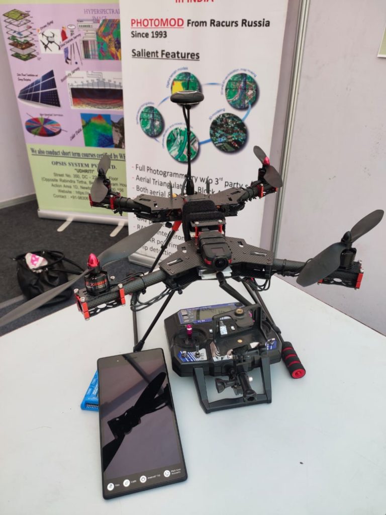
Now the drone is making a map
The first thing that comes to mind when we see a drone in the air is surveillance. On seeing the drone, it seems as if aerial surveillance is being done in that area. But the next time we see a drone in your area or nearby air, it is not necessary that the area is being monitored. Maybe they work of making a map is going on in your area.
Tapti Banerjee, director of the National Thematic Mapping Organization (NATMO), the central government organization that makes geographic maps across the country, says that under the digital mapping innovation program, the process of map-making across the country has been greatly improved. Moving out of the old system of surveying the place, we are using a drone to make a map .. It not only saves a lot of time, it is also almost 100 percent accurate. Assistant Director of NATMO, Anjali Sharma said that apart from drawing a map from the drone, in this digital mapping process, a student or any person can tell us the facts of their area online. We use those facts after examining them. With this, we keep getting information from many people and the area.
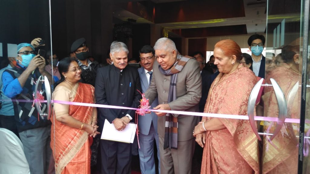
Today, the Governor of West Bengal, Jagdeep Dhankar inaugurated the 40th INCA International Congress in a five-star hotel. In the program, the governor said that in childhood, all of us have used the map while studying geography. It is very gratifying to know that now advanced maps are being made digitally. In the program, many scientists gave their views about their research.

 FOR WEST BENGAL JOINT ENTRANCE EXAMINATION 2024 IN BLUE LINE")


